
© Historic England, licensed to Cambridge Museum of Technology
This trail follows the railway line from Cambridge North Station to Cambridge Railway Station. You will visit some of Cambridge’s industrial heritage and discover another side of our world-famous city.
It was inspired by an aerial photograph taken by the United States Army Air Forces during the Second World War (see above). The railway, highlighted in yellow, runs right across the middle of the picture and many of the industrial heritage sites on it can still be seen today. We have also added some more recent sites which reflect Cambridge’s development.
We have prepared a glossary of bridge terminology here.
This trail can be followed on foot or by bike. You can visit every point or dip in and out depending on how much time you have available and how energetic you feel! Stops 1 to 10 are in green areas and are mostly on footpaths/cycleways. Stops 11 to 15 are in built-up areas and you need to be aware of moving traffic.
Take great care on roads and never go onto the railway tracks or near open water.
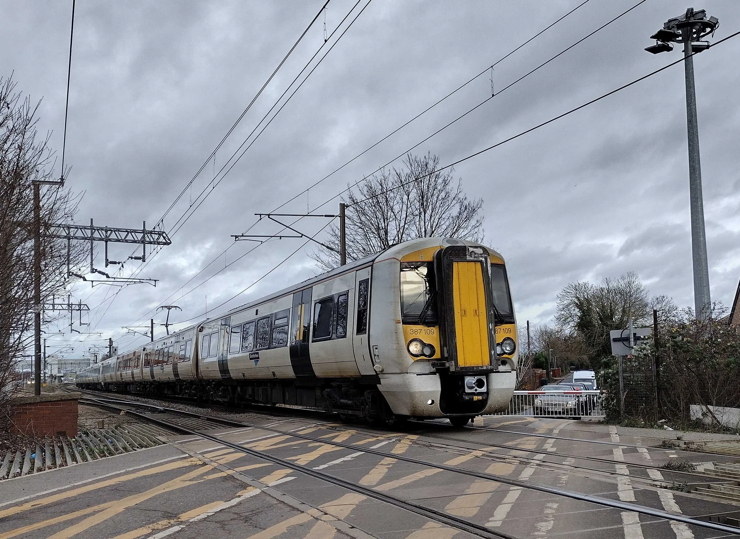
1. Cambridge North Station
View from: Station forecourt
Access: Open to the public
First proposed in 2003, the station finally opened in May 2017. Various names had been suggested including Stephen Hawking, Cambridge Science Park, Chesterton Interchange and Cambridge Fen. The station was designed by Atkins. The building is clad in aluminium bands and also includes large glazing panels. The aluminium exterior is decorated with a perforated pattern called Rule 30, a one-dimensional cellular automaton created by Oxford physicist Stephen Wolfram. Read more about it here Oh My Gosh, It’s Covered in Rule 30s!—Stephen Wolfram Writings.
Find Stop 2, Chesterton Junction: On leaving the station building turn left and head towards the bicycle racks. Cross the road at the zebra crossing. Turn left and follow the footpath/cycleway with the railway line on your left. Walk through Moss Bank, a residential road, and at the T junction with Fen Road turn left.
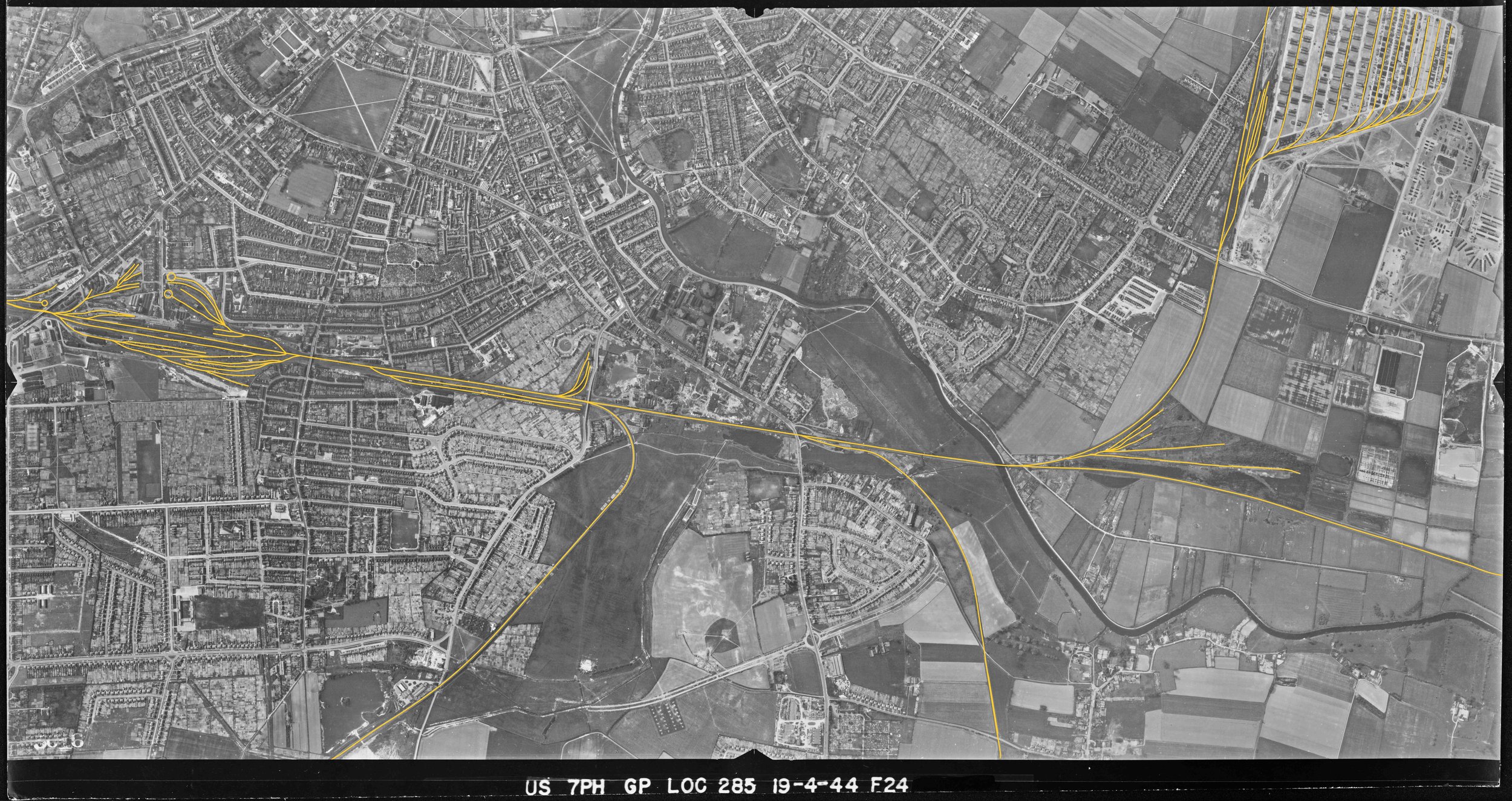
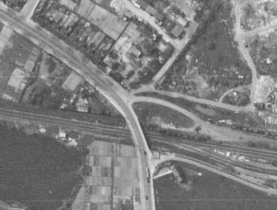
2. Chesterton Junction

Extract from USAAF aerial photograph April 1944
© Historic England, licensed to Cambridge Museum of Technology

Chesterton Junction in 1975. The short-lived (1850) station probably lay in the angle between the main line to Ely (right) and the St Ives branch (left). (Tony Kirby)
View from: Next to level crossing on Fen Road, look back towards Cambridge North Station
Access: Fen Road is open to the public at all times. DO NOT GO ONTO THE CROSSING IF THE GATES ARE CLOSED
Chesterton Junction dates from 1847, with the opening of the Cambridge–St Ives section of the Wisbech, St Ives & Cambridge Junction Railway, which joined the Eastern Counties Railway (ECR) Cambridge–Ely line just north of the bridge over the River Cam (Trail Stop 3). The line was extended from St Ives to March in 1848. On 19 January 1850 a ‘flag station’ (i.e. request stop) was opened here by the ECR: its exact location is uncertain, but it was probably in the V formed by the junction of the two lines. It proved unsuccessful, probably because of its remote location well away from Chesterton village, and appears to have closed within a few months. Cottages were built for railway workers on the site of the station, some of which survived until about 1959. Read more.
Find Stop 3, Chesterton Railway Bridge: Turn back and go down Fen Road until you reach a pinch point in the road with a footpath down to the river on your left. Head down the foot path and turn left onto the Cam towpath. This is where the horses which towed barges bringing goods to and from Cambridge used to walk before the railway became the major way of transporting goods.
3. Chesterton Railway Bridge
View from: The Cam towpath
Access: Towpath open to the public at all times
This is the third bridge carrying the railway line to be built on this site. It replaced an 1846 wooden structure and an 1870 plate girder bridge. The increasing weight of locomotives and trains necessitated these upgrades. The bridge, which is a Whipple Truss, formed from steel plate girders spanning between concrete abutments, spans 36m and weighs over 400 tonnes. The current bridge was built in 1930 with involvement from local firm Mackay. Mackay faced the challenge of installing the new bridge without closing the line for too long. The new bridge was built alongside the old. When the new bridge was complete, the line was closed and the old bridge was lifted onto a trolley and winched sideways. The new bridge was then winched into position. Track laying machinery rolled into action to lay the two lines and trains were running again within hours. Many people came to watch this happening. The brick arches (four north of the bridge, six south) that had formed the approaches to the old bridge were buried in an embankment. The line was electrified in 1992, and overhead cables were installed through the bridge superstructure.
Find Stop 4, The Pill Box: Walk underneath the Railway Bridge and look left.
4. Pill Box
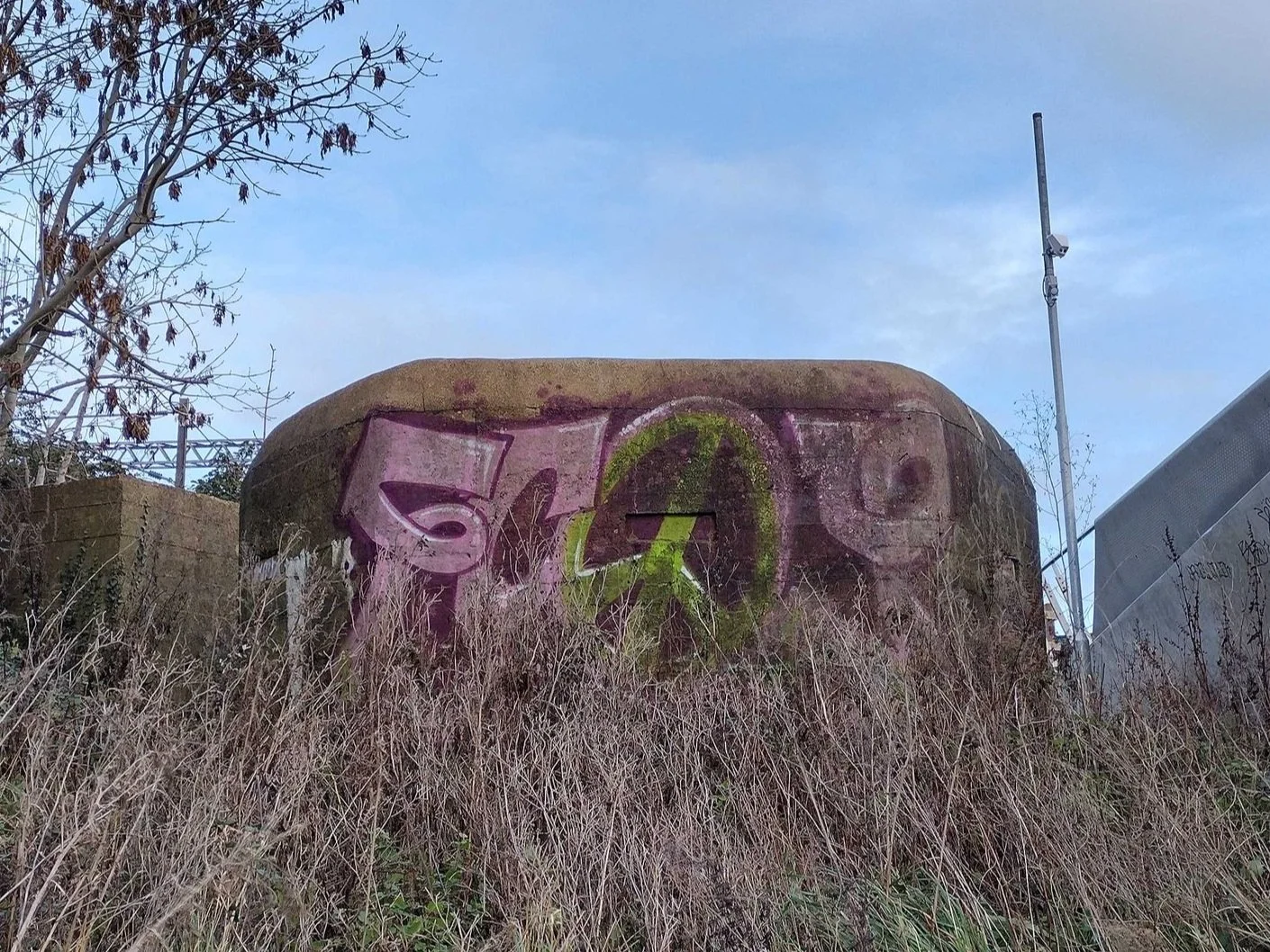
View from: The towpath
Access: Open to the public at all times
On the east side of the river, sandwiched between the two bridges, is an example of a Second World War concrete pillbox which formed part of the wartime defence system which stretched across the country. In the event of an invasion, the pill boxes could have been used to house look-outs and machine gunners. Pill boxes were sited at strategic points, often near rivers and railways.
Find stop 5, Abbey-Chesterton (Chisholm Trail) Bridge: It is right next to the Railway Bridge.
5. Abbey-Chesterton (Chisholm Trail) Bridge
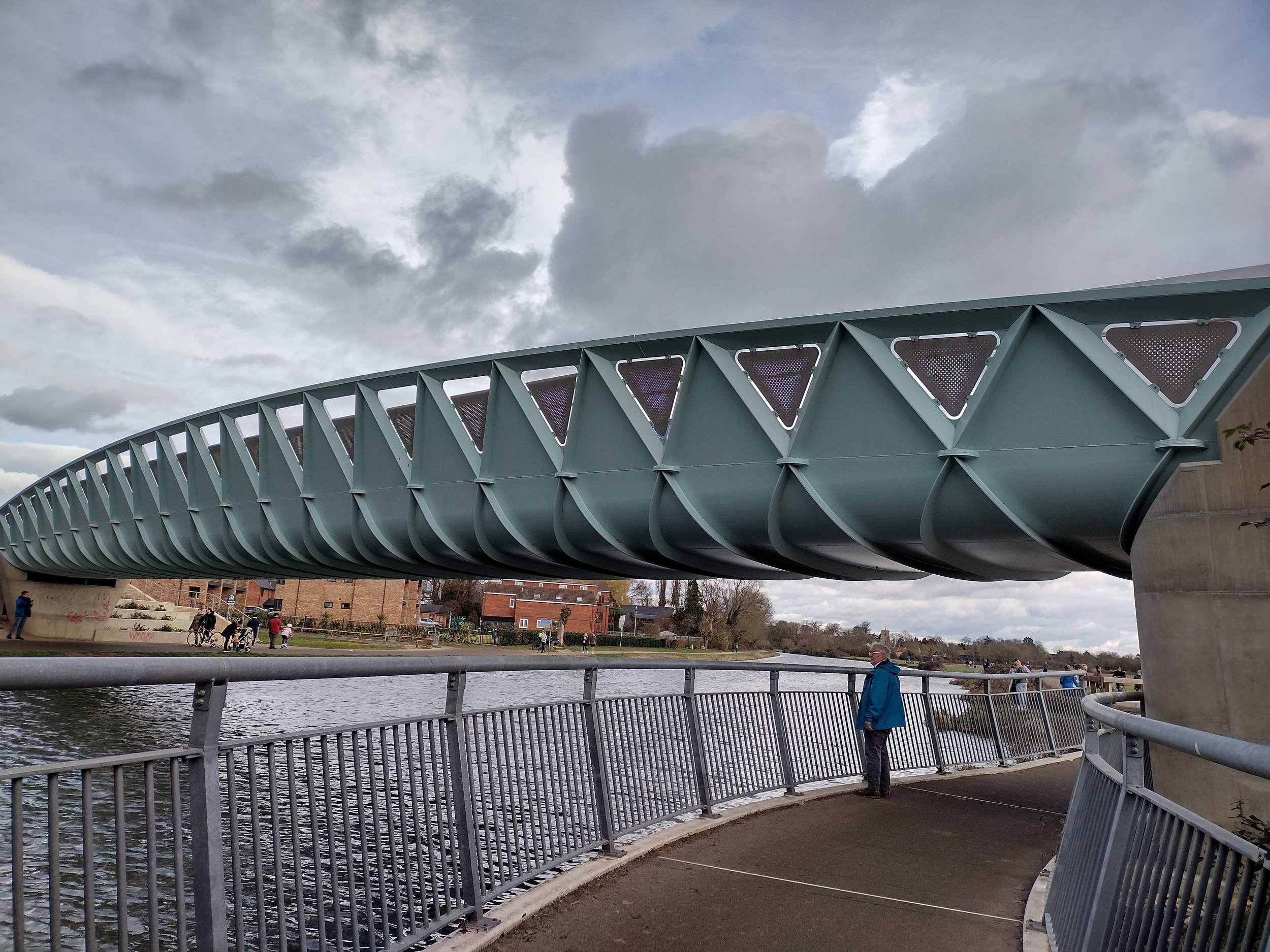
View from: The towpath and on the bridge itself
Access: Open to the public at all times
Not a railway bridge but requires mention as it sits directly alongside the 1930 railway bridge and was built partly to serve Cambridge North Station. This futuristically styled structure is Cambridge’s newest bridge, completed in 2021. It forms part of the Chisholm trail linking Trumpington to St Ives. It was opened by Jim Chisholm, a cycling campaigner who came up with the idea for the route which now bears his name. It is for pedestrians and cyclists only, and spans approximately 44m (the river is about 25m wide at this point). The bridge is formed as a steel trough with lattice strengthening. The designers were Knight Architects and SH Structures (Structural Engineers) and it was constructed by Tarmac.
Go to Stop 6, Stourbridge Common Footbridge: Go over the bridge and follow the footpath/cycleway until you find a post on your right with a small sign saying ‘Harcamlow Way’. This is a long-distance walking route which runs in a figure of eight from Harlow in Essex to Cambridge and back again. Follow the track over the stream and into the bushes and you will come to the Stourbridge Common Footbridge.
6. Stourbridge Common Footbridge
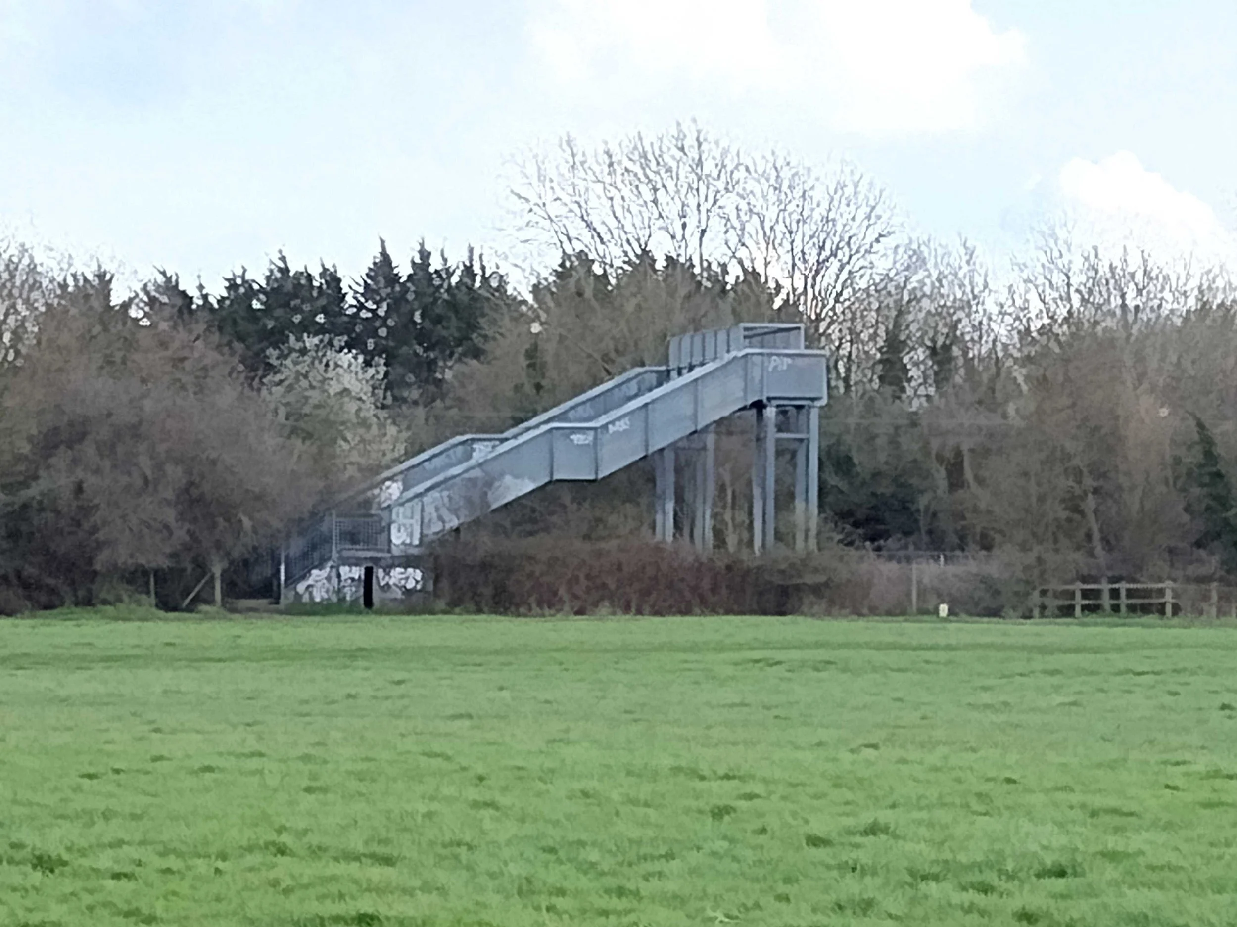
View from: The bridge itself.
Access: Open to the public but not easy to access with buggies or bikes
Giving pedestrian access across the railway through the common, this is a steel trough spanning about 15m and includes steep staircases (also formed as troughs) on both sides. Adjacent to the footbridge is a large culvert under the railway carrying Coldhham’s Brook towards the river.
Go to Step 7, The Leper Chapel: Retrace your steps to the footpath/cycleway and follow it around until you see a small medieval building on your right.
Or take a break and visit Cambridge Museum of Technology; check opening times here. Head over the bridge, walk over the grass to the footpath along the river and follow it until you reach Riverside where you will see the Museum entrance. Just aim for the tall chimney.
7. Leper Chapel
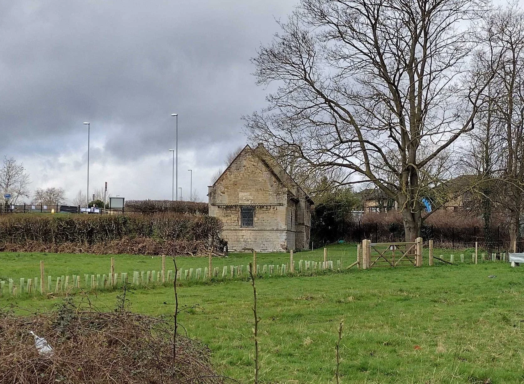
View from: The Chisholm Trail
Access: Private property in the care of Cambridge Past, Present and Future. Check their website for opening times Visitor Information Leper Chapel | Cambridge Past, Present and Future (cambridgeppf.org).
The remains of the 12th century hospital which cared for people suffering from leprosy and was therefore sited out of town. It fell into disuse but during the 1840s it was repaired so that services could be provided for the navvies working on the construction of the nearby railway. Grade 1 listed building.
Go to stop 8, Newmarket Road Twin Bridges: Follow the path underneath Newmarket Road. On the other side of the road you can look back to see the bridges.
8. Newmarket Road Twin Bridges

Extract from USAAF aerial photograph April 1944
© Historic England, licensed to Cambridge Museum of Technology
View from: Coldham’s Common
Access: Open to the public any time
There are two parallel bridges here to carry four lanes of traffic over the railway. The older bridge, on the northern side, has a reinforced concrete deck spanning the tracks between brick-arched approach ramps – it is likely that the original main span was also a brick arch which had to be removed to allow electrification of the railway. The southern bridge is more modern and is constructed in reinforced concrete between earth embankments. The main spans of both these skewed bridges are about 16m.
Go to stop 9, Barnwell Lake: The lake is in front of you when you come out of the tunnel underneath Newmarket Road.
9. Barnwell Lake

View from: Coldham’s Common
Access: Operated by Cambridge Fish Preservation and Angling Society About Us - Cambridge Fish Preservation and Angling Society (cambridge-fpas.co.uk) Beware of water!
This lake was once a pit where clay was excavated by companies making bricks. There was a thick seam of clay running along Newmarket Road and a number of brick companies operated in the area from the middle of the 19th century to the early 20th century. R J Flood, in an unpublished paper, suggests that this pit was worked by Reddings (1883-1892), Grays (1895) and Coldham Brick Co (1896-1922). The clay produced yellow/grey bricks which can be seen in many local houses of that era. It is now used as a fishing lake.
Go to Stop 10, Coldham’s Common Gatehouse (Weigh House): Follow the footpath across Coldham’s Common until you have almost reached Coldham’s Lane. The house is on your right.
10. Coldham’s Common Gatehouse (Weigh House)
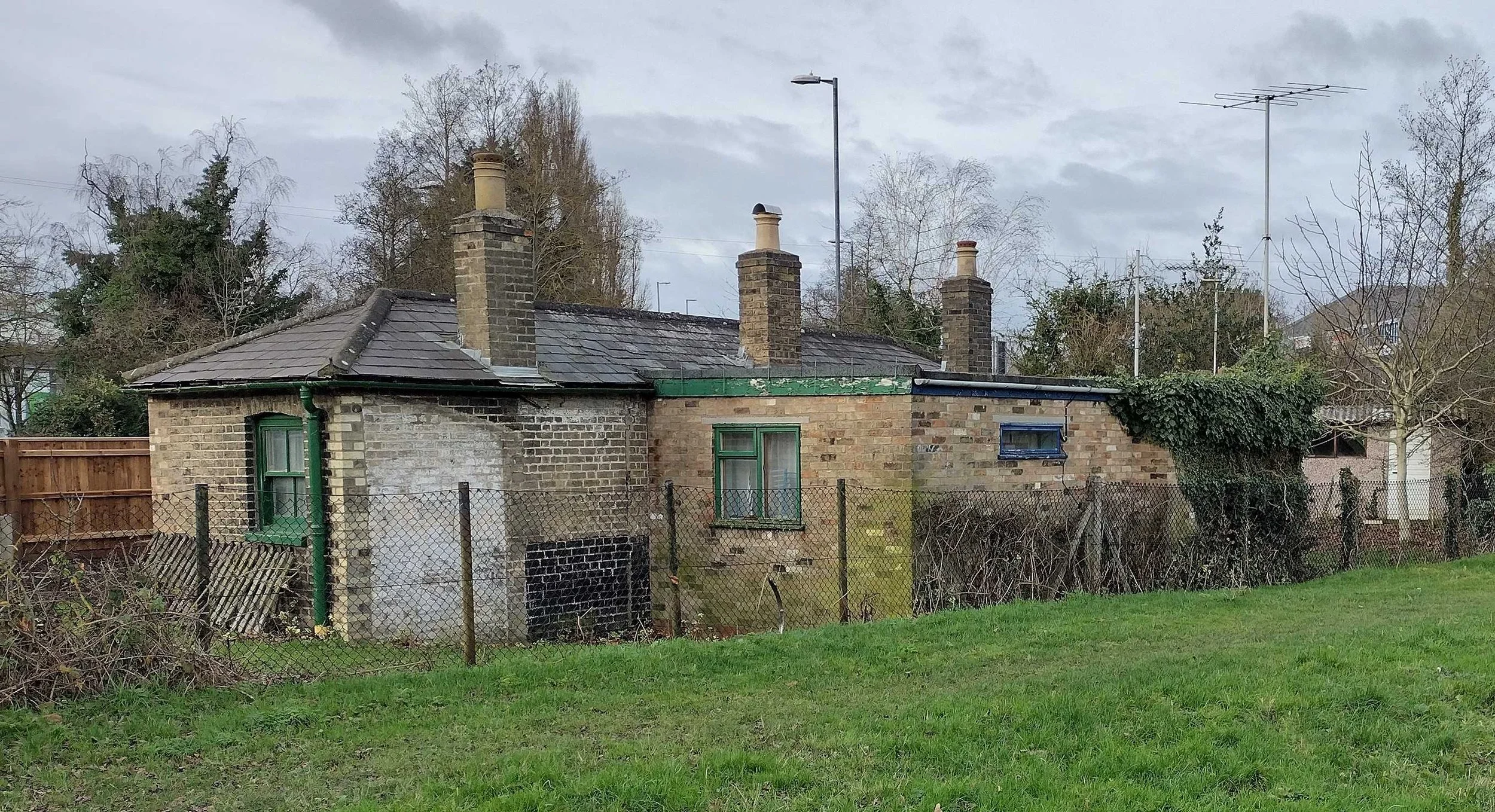
View from: Coldham’s Common or Coldham’s Lane
Access: Private property, no public access to the site.
A small, one-storey brick building constructed in 1858 probably using local bricks (see Stop 9). It was used as the weighing house for coprolites from open-cast mining on Coldham’s Common. Coprolites around Cambridge are nodules of phosphate which were used in the production of fertiliser in the 19th century. From the late 1880s the building was used as a house for the gatekeeper at Coldham’s Lane level crossing until the bridge was built (see Stop 11).
This is the end of the ‘green’ part of the trail. We are now heading into more built-up areas so keep an eye out for moving traffic at all times.
Go to Stop 11, Coldham’s Lane Bridges: Cross Coldham’s Lane at the pedestrian crossing then turn right. Walk up the pedestrian/cycle bridge.
If you would like to view the bridge arches then turn right before the pedestrian crossing and follow the path onto Coldham’s Road industrial estate as far as the bend in the road. TAKE CARE - FAST MOVING TRAFFIC, HEAVY VEHICLES AND UNEVEN ROADS AND PATHS, NOT SUITABLE FOR BUGGIES. Then retrace your steps to the pedestrian crossing and continue the trail over the pedestrian/cycle bridge.
11. Coldham’s Lane Bridges
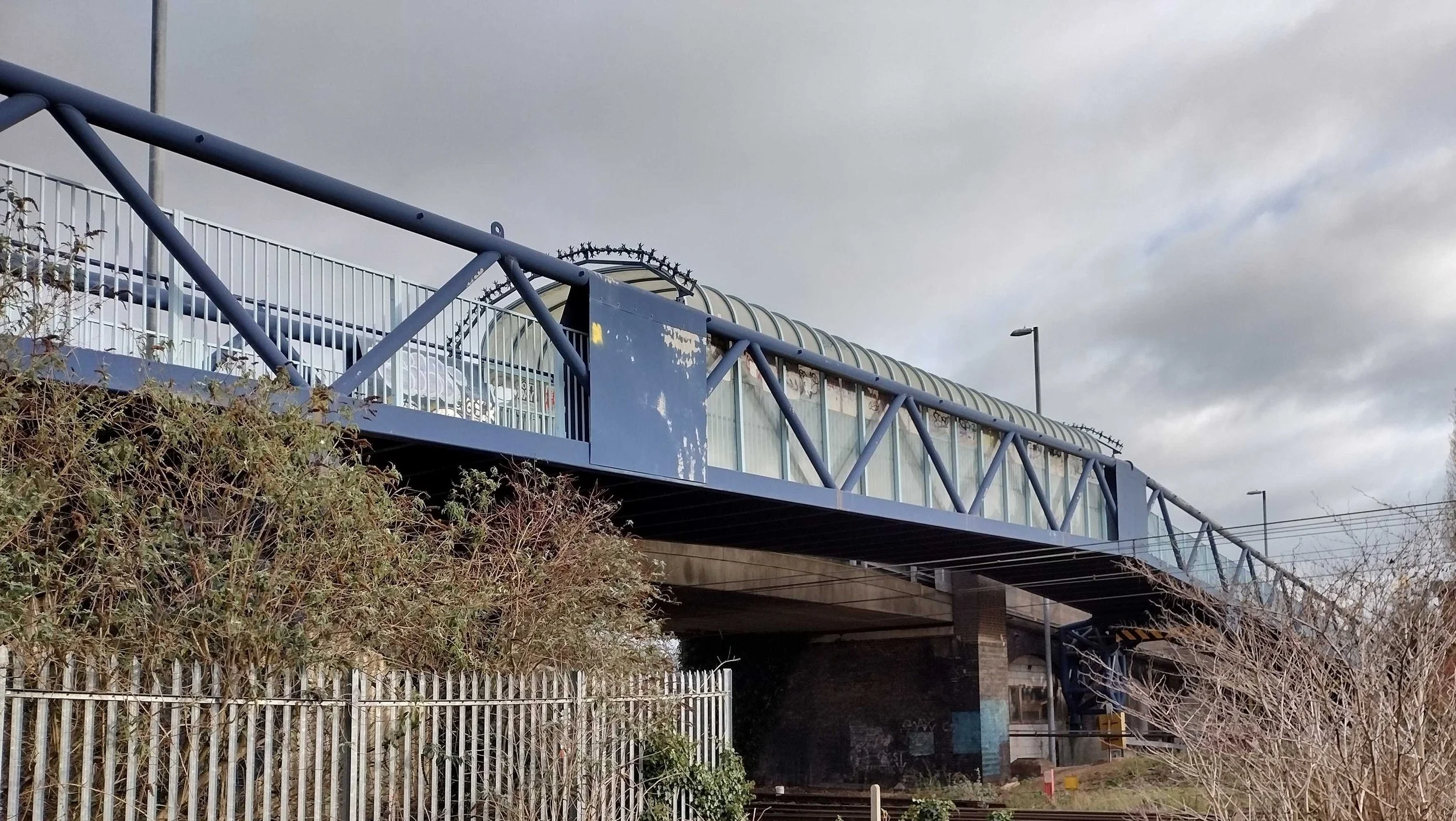

View from: The path onto the cycle bridge and also the car park at the Beehive Centre (see stop 12). View the arches from Coldham’s Road, but take care of heavy vehicles, fast moving traffic and uneven roads and paths, unsuitable for buggies.
Access: Open to the public any time
In 1845 there was a level crossing on this site. Coldham’s Lane was a busy road, up to 90 carts a day passed along it in 1875, including carts from the coprolite mining on Coldhams Common (see Stop 10). A gatekeeper was employed to open and close the level crossing gates when trains passed. The level crossing was replaced by the road bridge in 1896. The arches are still mainly in use for local businesses, accessible from nearby Coldham’s Road where there is a large range of industrial and retail premises alongside the main Great Eastern Railway and the Newmarket branch line which starts just after the bridge.
The road bridge has a reinforced concrete deck spanning approximately 20m between brickwork embankment arches – it is likely that the original main span was also a brick arch which had to be removed to allow electrification.
The cycle and footbridge alongside the road bridge dates from 2004 and has a total length of 104m, with a middle span over the tracks of about 28m. The bridge was built to provide a safer cycle route to this busy part of Cambridge and is a Warren truss formed from circular hollow-section tubes with anti-vandal glazing to sides and roof over the railway. The supports for the middle section over the railway are elaborate tubular-sectioned cantilevers from foundations right alongside the old railway arches.
Find Stop 12: Site of Cambridge University & Town Gas-Light Company railway sidings: Walk down the other side of the bridge and at the end of the railings on your left, walk down the ramp to the Beehive Centre carpark. Cross over the entrance to the goods yard behind the shops. With your back to the line of shops look across the car park. This area is on the site of the railway sidings.
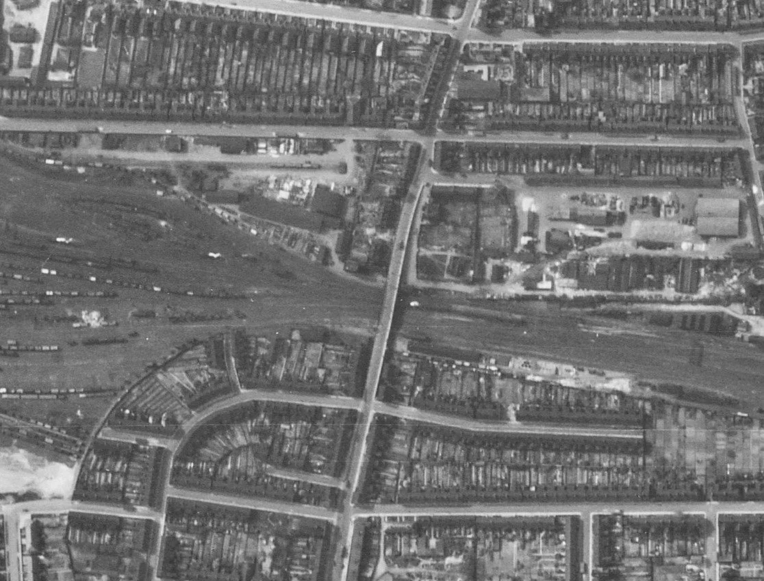
12. Site of Cambridge University & Town Gas-Light Company railway sidings
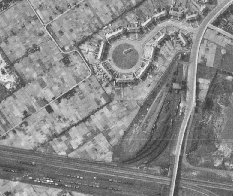
Extract from USAAF aerial photograph April 1944
© Historic England, licensed to Cambridge Museum of Technology
View from: There are no visible remains of the sidings but the site can be viewed from the Coldham’s Lane end of the Beehive Centre car park
Access: Open to the public any time
When railways arrived in Cambridge in the mid-19th century, the raw material (coal) for the University & Town Gas-Light Company gasworks, which was bounded by River Lane, Newmarket Road and Riverside, could be sourced nationally and transported by rail. This was more economical than the previous sea-river route from Newcastle to King’s Lynn to wharves on the river Cam. With coal now delivered via the railway, the gasworks faced a new challenge: 'final-third-of-a-mile' delivery from railway sidings at Coldham's Lane to the retort houses on River Lane. Company records in the 19th century reveal proposals for a tramway. However, the potential disruption of a tramline across Newmarket Road, combined with the introduction of motorised vehicles, resulted in the introduction of a fleet of gas-powered vehicles during the 20th century.
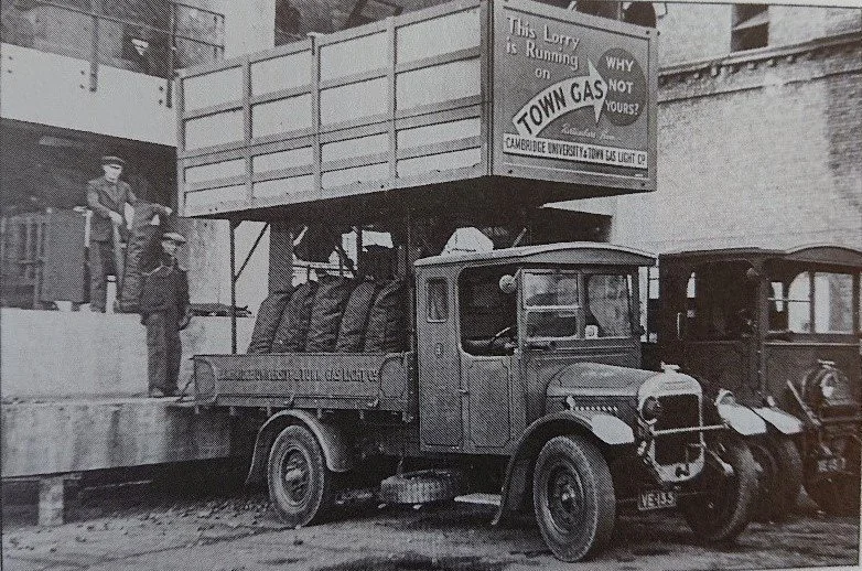
Photo: The Cambridgeshire Collection
In the 1944 USAAF aerial photograph of Cambridge, individual goods wagons are clearly visible in the Coldham’s Lane sidings that spurred north-west from the main railway line. These sidings were removed as the site was redeveloped for commercial use after Cambridge gasworks ceased production of coal-gas in the 1960s and switched to the storage of North Sea gas.
Find Stop 13, Mill Road Bridge: This is quite a long walk but there are pieces of Cambridge industrial history to see along the way. Walk along the pavement in front of the shops until you come to a narrow cycleway / footpath which cuts between B&M and Subway. Follow this path, which is called Vera’s Way, around the loading bays of the shops until you emerge onto Sleaford Street where you should turn right. Shortly after coming onto Sleaford Street you will see a straight, private road on your right which includes a row of garages. This is part of the Rope Walk, where long sections of rope could be made. It appears on Baker’s map of the University and Town of Cambridge in 1830. At that time there were no buildings around it. Take the first left into Ainsworth Street and go straight ahead until you meet a T junction with Hooper Street. Look at all of the houses, many of them built using local bricks (see Stop 9. Barnwell Lake). At the T Junction turn right onto Hooper Street and then take the first footpath on your left. This takes you onto a new estate but its street names remember the ironworking industry in Cambridge. Eagle Street is named after the Eagle Foundry and Headly Street recalls the Headly family which ran various iron foundries in Cambridge including the Eagle Foundry. At the end of Eagle Street turn right into Headly Street and follow the road around until you get to Mill Road. At Mill Road turn right and walk to the top of the bridge.
13. Mill Road Bridge


Extract from USAAF aerial photograph April 1944
© Historic England, licensed to Cambridge Museum of Technology
View from: the bridge itself
Access: Open to the public any time
When Cambridge station opened in 1845, Mill Road was a country track linking Cambridge and Cherry Hinton. Soon after opening the line gates were installed and a gatekeeper employed, living in a cottage on site, to operate the gates. Growth of the Mill Road area, thanks to the railway, meant that by 1880 a footbridge had been installed in response to public demand. The first road bridge was built in 1889. Its abutments caused the inhabitants of adjacent houses to be overshadowed, but the bridge made life easier for businesses and local people needing to go into and out of the centre of Cambridge.
The bridge you can see today was constructed in1980 when the old bridge was rebuilt to meet the needs of modern traffic. This bridge is much altered from the original brickwork arched construction. The 20m-long main span was changed to a steel trough to allow electrification and a new concrete section incorporated in the eastern approach to accommodate a new siding to a coach wash. The inside faces of the road parapets have been decorated with murals by local artists and the wide southern footpath has communitive seats and a Dinky Door (innovative mini-sculptures forming a new trail through Cambridge).
Go to Stop 14, The Carter Bridge: Retrace your steps to the bottom of Mill Road bridge. Cross to the other side of Mill Road when safe to do so. There is a pedestrian crossing at the junction with St Barnabas Road and Gwydir Street. Go down Devonshire Road. At the bend in the road turn left onto cycle way / footpath into the car park at Cambridge Station. The Carter Bridge will be in front of you.
14. Carter Bridge
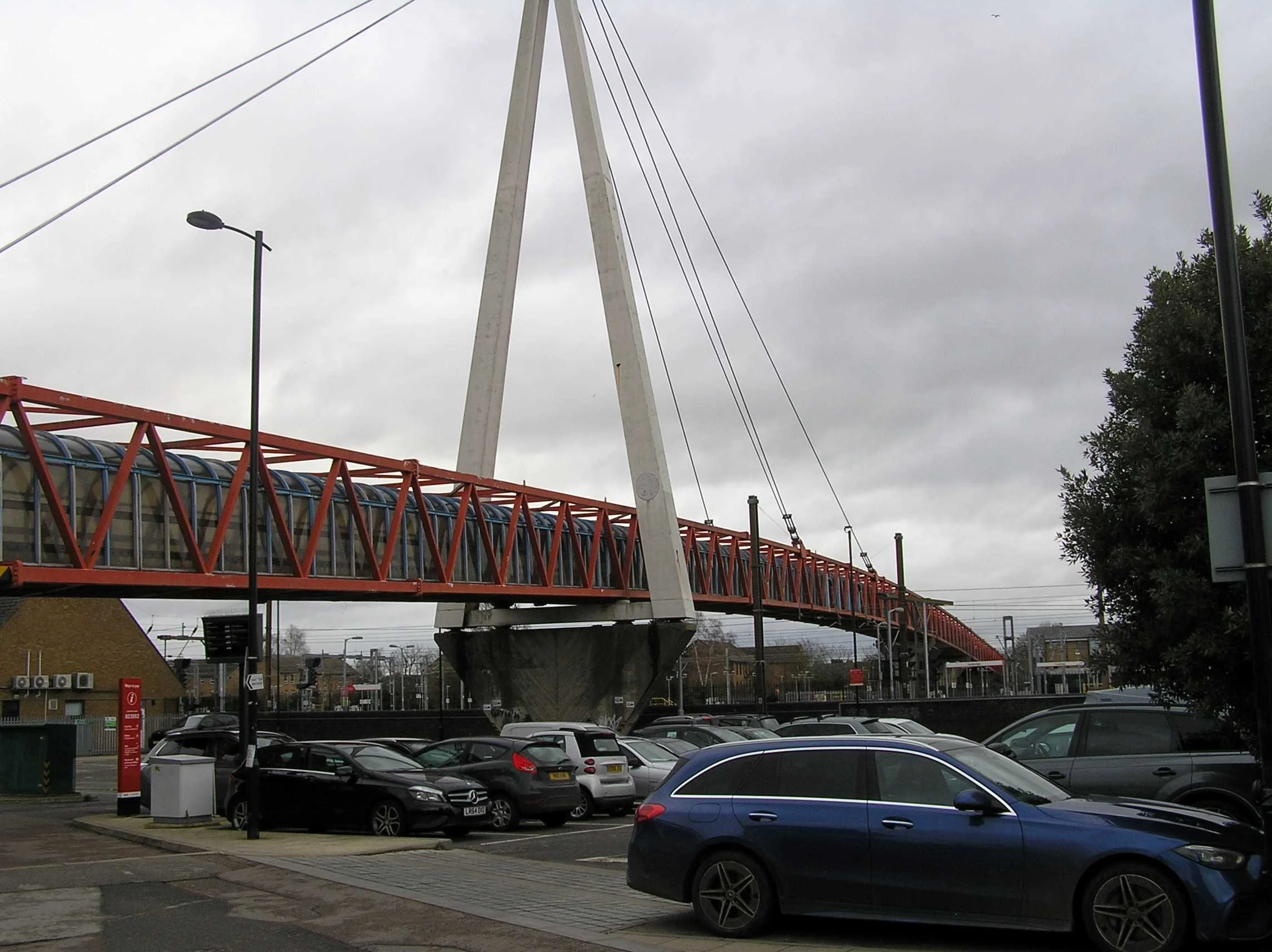
View from: Railway Station car park. Look out for moving cars and bikes
Access: Open to the public any time
This £2m, long, tube-like bridge was constructed in 1989 as a response to the increased number of accidents involving cyclists on the Hills Road and Mill Road entrances to the city. It crosses 15 railway tracks at the station and is over 230m long. In form the bridge is a three-span cable-stayed structure with a main section over 90m long. Cable-stayed bridges are an economic method of creating large spans, where the main vertical loads are carried by long cable fans, supported from high towers, and anchored by more cables to one or more of the back spans. Horizontal loads, due to winds (which can be substantial) are resisted by stiff bridge decks often in the form of trusses. For the Cambridge Cycle Bridge (which is the locally common name, rather than the opening name of the Carter Bridge – in honour of a local councillor), the vertical sides of the tube are Warren Trusses while the top and bottom are formed from braced Vierendeel girders. Over the railway the walkway and cycleway across the bridge are totally enclosed to prevent items falling on to the tracks. At its time of opening this was the longest cycle bridge in the UK.
Go to Stop 15, Cambridge Railway Station: Continue through the car park. Watch out for moving traffic. Get onto the footpath which runs outside the multi-storey bike park, and follow the path around to the left until you reach Station Square.
15. Cambridge Railway Station

The GNR station building, 2021, following refurbishment (Tony Kirby)

The exterior of Cambridge station, 1975, with a magnificent collection of cars of the period and Eastern Counties’ service 101 to Chesterton just getting into the picture (Tony Kirby)

Extract from USAAF aerial photograph April 1944
© Historic England, licensed to Cambridge Museum of Technology
View from: Station Square
Access: Open to the public at all times
Opened 29 July 1845 by the Eastern Counties Railway, on a site well outside the town was because of University pressure. The Italianate main building was designed by either Sancton Wood or Francis Thompson (possibly the two in conjunction), with arms of the colleges in the spandrels of the exterior frontage. Constructed of local brick, with stone window surrounds and cornices, it originally had two colonnades, one covering the single platform and its track, the other forming a cab entrance. In 1851 an island platform was added to the east and the original relegated to luggage traffic. This led to complaints of congestion on the narrow footbridge and in 1862-3 (when the ECR re-named itself the Great Eastern Railway) the station reverted to a single-platform layout, now lengthened to accommodate two trains at once and with a central crossover. The rail-side colonnade was demolished at the same time. The front colonnade was later incorporated into the building, but the semicircular windows at each end are a reminder of it. There were many internal changes over the years as passenger numbers increased; the latest remodelling, opening up much of the interior for the first time, being carried out by Network Rail in 2017. What was effectively a second station was added (today’s platform 3) for the Great Northern Railway, which had failed in its attempt to secure a town-centre location. That station building is now a Subway fast-food restaurant. The other companies working into Cambridge used the GER platforms: the London & North Western ran trains to Bedford, Bletchley and Oxford from platform 2, while the Midland services to Kettering left platform 6. The island platform (7 and 8) was added by Network Rail in 2011.
There were extensive goods yards around the station. The GER’s depot was on the east side where the Post Office Sorting Office is today, the GNR’s was in the angle between Station Road and Hills Road, the Midland’s was at Devonshire Road (hence the ‘Midland Tavern’, now the ‘Devonshire Arms’) and the LNWR’s at Brooklands Avenue. All except the Midland also had its own engine shed, the GER’s adjoining platform 6 , the site now occupied by the Ibis hotel and station car park, the GNR’s near the GER goods depot and the LNWR’s at Brooklands Avenue, but from the late 1920s all used the GER (now LNER) shed, which acquired a mechanical coaling plant, one of the tallest buildings in Cambridge around 1935.
The railway was a major employer in Cambridge and from the early 1850s Romsey Town was developed on the eastern side of the line along Mill Road to house railway workers although few houses were built by the railway itself, other than a small group near Mill Road bridge for the ‘superior officers’ of the ECR. On the town side of the railway, the landowner, Jesus College, built substantial semi-detached houses along Station Road; most were demolished in the late 1960s, other than those between Tenison Road and Hills Road, and replaced by office blocks, themselves replaced in the early 21st century as part of the CB1 development, which also subsumed the GNR goods yard and Foster’s Mills of 1855 onwards.